The town centre, five times over
Every phone in Arendal sentrum, counted every ten minutes.
Fast facts
The festival curve
Daily peak since 6 July. Five ordinary weeks — then Monday.
Show the numbers
Where they come from
Nine in ten phones are Norwegian — this festival is Norway talking to itself. Bars show each country's share of the visitors; the badge is growth on a normal week.
“Rest” is the operator's catch-all for everywhere else. Counts are averages across festival readings.
The week, hour by hour
Every festival day (10–14 Aug), overlaid. Tap a day to pick it out.
You can see the opening ceremony
Monday. The climb stops dead at 14:00 — exactly when the speeches start.
Where do I park?
Day one's most-searched word in Arendal.
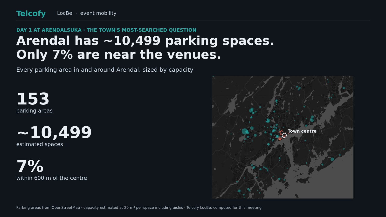
Not short of parking. Short of parking where people are going.
So park once, and ride in
Four sites could take the cars before they reach town.
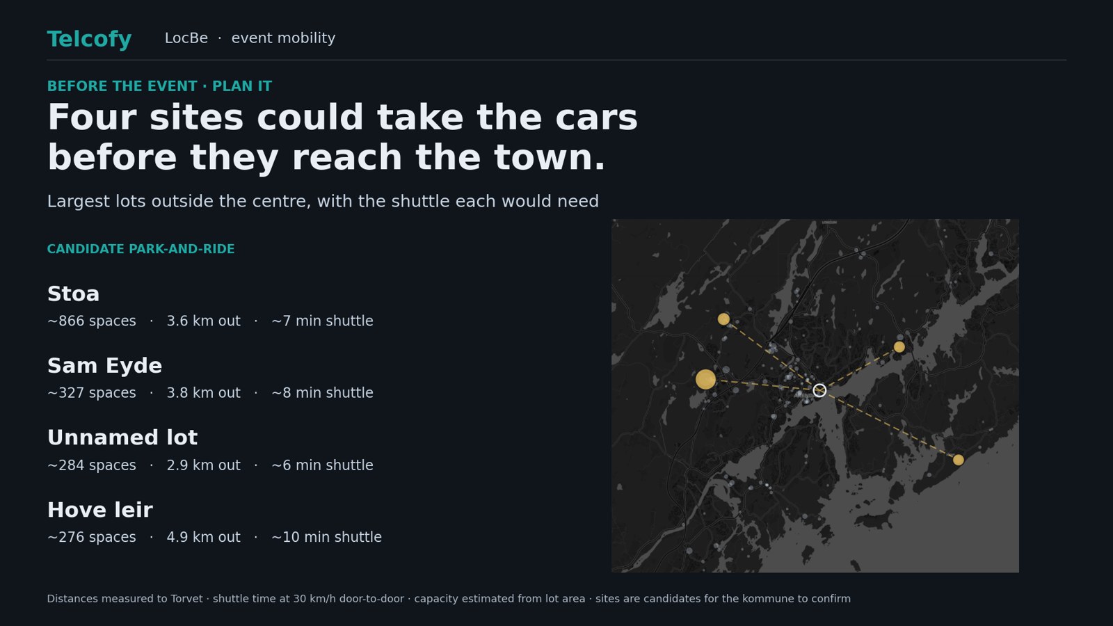
Stoa alone holds more cars than the whole town centre. Parking from OpenStreetMap; shuttle at 30 km/h.
Green, amber, red
Daily parking advice, the way a driver actually wants it.
Measured: how busy the town centre actually was, hour by hour, across Arendalsuka.
Per-car-park lights are illustrative — each site needs its own zone. The hour strip above is measured.
What a host town could run on this
Three questions. Every event asks them.
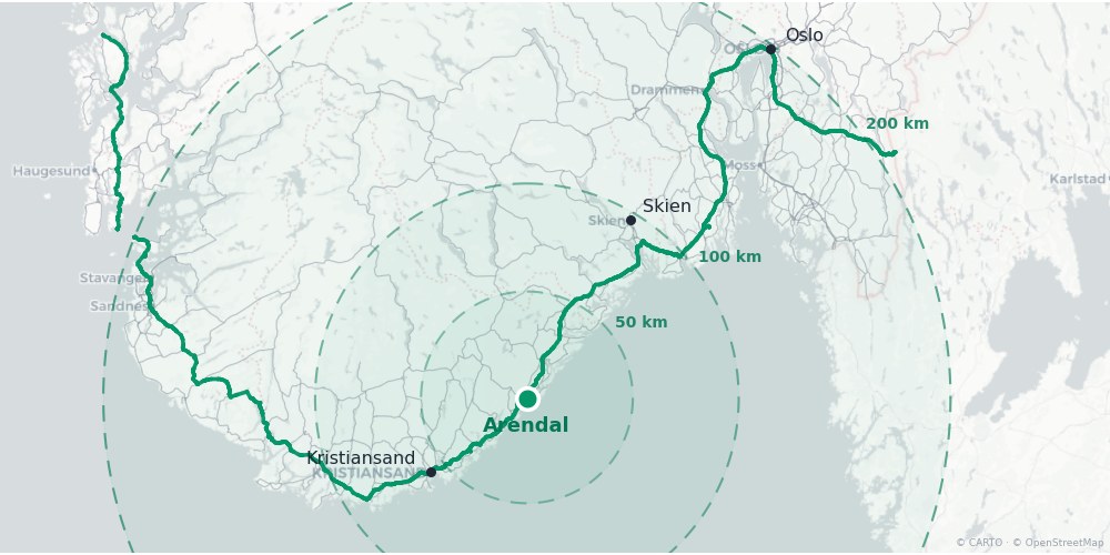
Who can reach you
The step between those two numbers is Oslo — and it arrives down the E18.
Watch it fill
Full site triggers the signs and the shuttle.
Prove it
This year calibrates next year.
The same engine, on a bigger problem
When E18 at Fornebukrysset dropped from three lanes to one, we modelled where the traffic would go instead — every road in Bærum and Oslo, reassigned.
Traffic leaves the motorway and reappears on Bærum's residential streets — Kveldsroveien, Sandviksveien, Høviksvingen — not on the signed detour. Same idea as a full car park: the overflow has to go somewhere, and it is better to know where before it arrives.
Devices, not people — how to read this
Counts of mobile devices seen by the network inside a 0.37 km² box over Arendal sentrum. One person may carry two; not everyone is on this network. The ~3,000 baseline is mostly residents and passing traffic, so the festival crowd is the lift above it, not the total. Friday 14 August is a part-day reading (ends 15:00) — drawn hollow.